Tamil and English poster exhibition in the former Governor's Residence
In 2015, the National Museum of Denmark's Tranquebar Initiative produced a poster exhibition with Tamil and English texts for a public audience as required by the Tourist Department, Tamil Nadu Government who owns the house. The aim of the exhibition is to illustrate the architectural history of the building and to give glimpses of the life previously lived in the house in the Danish Era and beyond.
Notions of gratitude, see here!
See the Tamil and English poster exhibition on the Governor’s Residence. Click here!

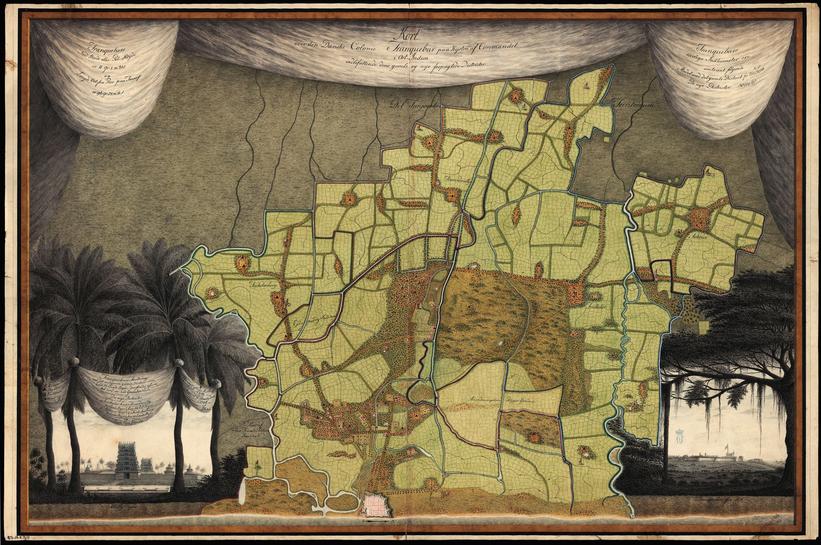
In 1798, this detailed map of the territory of Tranquebar was drawn by Peter Anker who served as Danish governor from 1788-1806. The map is based on surveys conducted by the engineer, Captain Mathias Mühldorff, ten years earlier. A red borderline marks the fortified town of Tranquebar with the surrounding territory of fourteen villages first allotted to the Danes by the king of Thanjavur. The map also shows the location of the new districts, which had been included in the Danish territory as security for loans to the ruler of Thanjavur. A range of features is marked on the map, including military posts (indicated with the Danish flag), important temples, bridges and rest houses for travelers. Surrounding the villages are fertile paddy fields and palm groves. As decorative emblems, the map is furnished with cartouches. The cartouche to the left depicts one of the largest temples in the territory, located in Thillaiyali, and the one to the right depicts a large banyan tree which frames Tranquebar as seen from the southwest, showing the fort, the fortification of the town and ships at anchor. HM Queen Margrethe II’s Private Reference Library, Amalienborg Palace, Denmark
Text: Professor Esther Fihl and Research Assistant Caroline Lillelund, 2015
Web design and supervision: Assistant Curator Bente Gundestrup
Language editing: Research Assistant Manasa Bollempali
